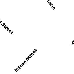
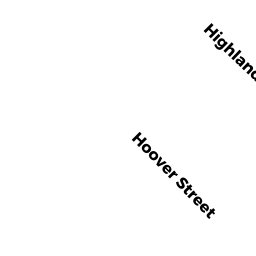
133 HIGHLAND STREET
Owner Information
BAGNALL CHRISTOPHER D & MARILYN
133 HIGHLAND STREET
TAUNTON, MA 02780


Property Details
133 HIGHLAND STREET is classified as a Single Family Residential (Old style).
The primary structure on this property was built in 1938. There are 4,294ft2 of built area within this property. There is 2,498ft2 of residential/living space within this property. This property is listed as having 8 rooms.
133 HIGHLAND STREET is valued at $306,600. The land is valued at $104,100 and the structures are valued at $194,800. There is an additional valuation of $7,700 on this property.
This property is in Zone 3.31. Confirm with local Zoning Board authorities to ensure there are no overlays or other easements on this property.
The most recent deed for 133 HIGHLAND STREET is recorded at the local registrar in Book 2625, Page 0002. 133 HIGHLAND STREET was last sold on Thursday, January 10, 1985 for $0.
Assessment data from fiscal year 2021.
Flood Data
According to the FEMA National Flood Hazard Layer, this property does not appear to be in a flood zone. It may also be in an area not yet reviewed. Nonetheless, confirm this information prior to taking any action.
To view the flood hazards around this property, create a FEMA "Firmette" Map of the area around 133 HIGHLAND STREET.
Broadband Internet Providers
| Provider | Type | Bandwidth (mbps) | |
|---|---|---|---|
| T-Mobile | Fixed Wireless | 25 | 3 |
| VSAT Systems, LLC. | Satellite | 2 | 1 |
| HughesNet | Satellite | 25 | 3 |
| GCI Communication Corp. | Satellite | 0 | 0 |
| Viasat Inc | Satellite | 100 | 3 |
| Verizon New England Inc. | DSL | 10 | 1 |
| Verizon New England Inc. | Fiber | 940 | 880 |
| Comcast | Cable | 1000 | 35 |
Broadband service provider data from December 2020.
Adjacent Properties
- 125 HIGHLAND STREET #404
Residential Condominium owned by CROWELL PAMELA V - 125 HIGHLAND STREET #403
Residential Condominium owned by BARRY THERESA & JOHN - 125 HIGHLAND STREET #302
Residential Condominium owned by HASAN LATEEF N - 125 HIGHLAND STREET #402
Residential Condominium owned by MARTINS JOYCE G TRS LI - 125 HIGHLAND STREET #308
Residential Condominium owned by KIERNAN EDWARD - 125 HIGHLAND STREET #304
Residential Condominium owned by MONTANI DANIEL - 125 HIGHLAND STREET #204
Residential Condominium owned by UNGARO ELISA - 125 HIGHLAND STREET #405
Residential Condominium owned by SWARTZ NATHAN R - 125 HIGHLAND STREET #401
Residential Condominium owned by PARRISH, CHRISTY J - 125 HIGHLAND STREET #109
Residential Condominium owned by WYNN ROBERT D - 125 HIGHLAND STREET #312
Residential Condominium owned by KURTZMAN, RICHARD - 125 HIGHLAND STREET #103
Residential Condominium owned by LAFRANCE JENNIFER TRS - 125 HIGHLAND STREET #203
Residential Condominium owned by APONTE JENNIFER - 125 HIGHLAND STREET #206
Residential Condominium owned by MORALES AIDA L - 125 HIGHLAND STREET #113
Residential Condominium owned by LEHOUILLIER BETH A - 125 HIGHLAND STREET #311
Residential Condominium owned by WEI WEI - 125 HIGHLAND STREET #112
Residential Condominium owned by MORTLAND NANCY - 125 HIGHLAND STREET #306
Residential Condominium owned by GAMERMAN MARK A TRS - 125 HIGHLAND STREET #110
Residential Condominium owned by DECKEL KIMBERLY N - 125 HIGHLAND STREET #114
Residential Condominium owned by POOLE CHRISTOPHER S - 125 HIGHLAND STREET #111
Residential Condominium owned by BOUTCHIA ERNEST H & LORI J - 125 HIGHLAND STREET #201
Residential Condominium owned by FORTUNA CLIFFORD - 125 HIGHLAND STREET #107
Residential Condominium owned by MORRISEY TODD & KATHLEEN - 125 HIGHLAND STREET #105
Residential Condominium owned by BOTELHO DEANNE - 125 HIGHLAND STREET #313
Residential Condominium owned by TYNAN JESSICA N - 125 HIGHLAND STREET #202
Residential Condominium owned by WATSON GRAHAM - 125 HIGHLAND STREET #106
Residential Condominium owned by AFFONSO SHANNON M - 125 HIGHLAND STREET #102
Residential Condominium owned by SABEN BARRETT E - 125 HIGHLAND STREET #406
Residential Condominium owned by WHITE ELIZABETH M - 125 HIGHLAND STREET #305
Residential Condominium owned by ELDER JESSICA S - 125 HIGHLAND STREET #303
Residential Condominium owned by TONELLO MATTHEW J - 125 HIGHLAND STREET #301
Residential Condominium owned by BOOTH KIMBERLY A - 125 HIGHLAND STREET #104
Residential Condominium owned by TRIPP LYNDA H & JOHN S - 125 HIGHLAND STREET #309
Residential Condominium owned by TURNER THOMAS C & LAUREEN A - 125 HIGHLAND STREET #101
Residential Condominium owned by DUMAS WILLIAM F - 125 HIGHLAND STREET #108
Residential Condominium owned by SHADRACH KRUPANIDHI P - 125 HIGHLAND STREET #310
Residential Condominium owned by SPIRO BRIAN T - 125 HIGHLAND STREET #307
Residential Condominium owned by ROBERTSON PAMELA - 125 HIGHLAND STREET #314
Residential Condominium owned by PEREIRA CAROLYN - 125-125 HIGHLAND STREET
Other, Open Space owned by CONDO MAIN - 125 HIGHLAND STREET #205
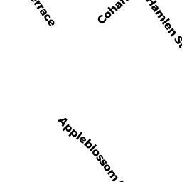
Residential Condominium owned by PRICE PAMELA L - 67 APPLEBLOSSOM LANE
Single Family Residential owned by REDMOND WAYNE M & LARAINE A - 135 HIGHLAND STREET
Single Family Residential owned by BASTIEN CHRISTOPHER